I'm not one to usually go to Google itself to learn about Judaism, but I feel that the circumstances around how I discovered this is really intriguing...
Google Maps has a nice little feature that allows you to measure distance on the map using a virtual ruler. To activate it, you will need to enable it in Maps Labs (available by clicking the "settings" icon in the upper-right corner). Then click on the little ruler-icon on the lower left corner of the map.
Once you have it running, you will be able to measure the distance between two points on the map. By default, the measurement is taken in meters. You can select "english" units or "metric units" OR you can click "I'm feeling geeky", which will let you take the measurements in anything from American Football Fields to Light-years.
But what struck me as odd is that Google listed three additional methods of measurement:
- Jewish 1st Temple cubit
- Jewish 2nd Temple cubit
- Jewish 2nd Temple sacred cubit
Doing some quick calculations Google gives these in modern-terms as (approximately):
- Jewish 1st Temple cubit = 1.405 ft.
- Jewish 2nd Temple cubit = 1.458 ft.
- Jewish 2nd Temple sacred cubit = 1.436 ft.
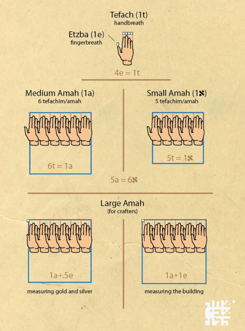
As far as I can recall, I only know of one type of cubit (a.k.a. Amah). So what is the origin of these three types of cubits?
And a screenshot, for your convenience:


